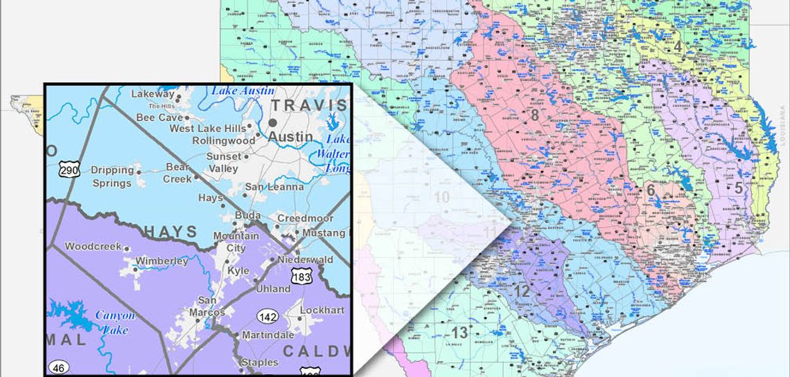
One glance at the Texas Water Development Board’s map delineating 15 flood planning regions spread out over the vastness of the state and it becomes clear: Region 11, the Guadalupe River Basin, is a very small slice.
The regions are based on watersheds, and the Guadalupe basin contains only 10 counties from Kerr County to Calhoun County on the coast. Only the southern portions of Hays and Blanco counties are included – and the whole thing is dwarfed by the Colorado/Lavaca region to the north and east, and is visibly smaller than Region 12, the San Antonio River Basin.
It’s indicative of just how much water is produced by the state’s two largest springs systems, Comal and San Marcos.
The map was produced as part of water planning initiatives in the wake of an amendment to the Texas Constitution that was overwhelmingly approved by voters last November.
Proposition 8 provided for the “creation of a flood infrastructure fund” to be tapped to fund regional infrastructure like drainage improvements, flood mitigation and flood control.
In the past, city and county governments and water planning regions were based more on political subdivisions than where the water is going to flow.
The question of flooding is not if but when. Central Texas has experienced three 100-year floods within the past
decade and Hurricane Harvey (2017) and Imelda (2019) dumped many feet of water across the southeast part of the state.
Planners say some of those events, like the May 2015 flood in Central Texas and the drenching rains of Harvey (rainfall measured 60.58 inches in Nederland), cannot be mitigated or engineered. However, they say rainfalls
of 10 to 12 inches can and should be.
“The water will go where water wants to go,” Rep. Dale Phelan (R-Orange) said during a presentation in San Marcos last fall that was part of a “speaking tour” to encourage Texans to approve Proposition 8.
“Floodwaters do not respect political boundaries,”Phelan said, calling Harvey a wake-call to planners that they need to set political differences aside and cooperate.
On April 16 at 10 a.m. the TWDB will host a web-based overview on the Flood Infrastructure Fund (FIF) and some intended uses. (register at https://register.gotowebinar.com/register/5864922971989208076).
The FIF is a one-time transfer of $793 million from the state’s “rainy day fund.”